


![1st Apr: It Takes a Village (2026), 1hr 36m [TV-PG] (5.6/10)](https://occ-0-8164-92.1.nflxso.net/dnm/api/v6/Qs00mKCpRvrkl3HZAN5KwEL1kpE/AAAABSI4kBfQQ2--yKO4uIcfQwbfXFPHuzp5qSaDvUVeTuVsTuG_1WKGgpN2WuZg7X_D1JKOuPkkJZaXL5_Umm1yO_NWu_deQbHtWUH4lHGTGCrG6Ivcv4lB4pJmjyX9aaA6AJrJJrmRQmn72cZFZdSjOQ51P3gFTv4Rn62B9MTLIjBVNQ.jpg?r=ef7 "1st Apr: It Takes a Village (2026), 1hr 36m [TV-PG] (5.6/10)")


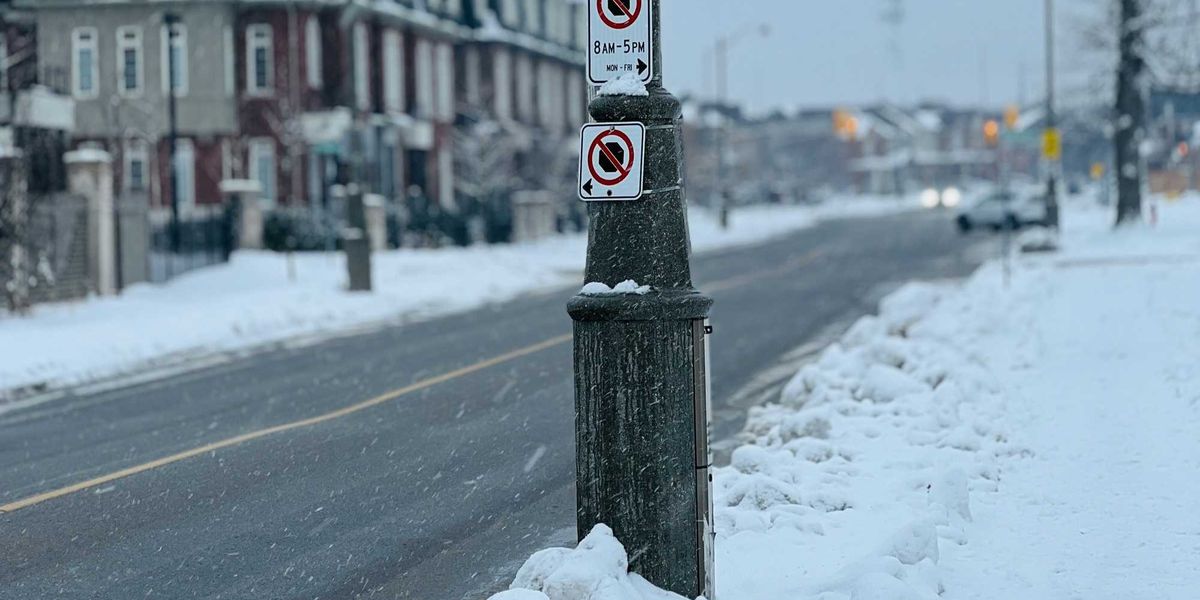
A new forecast said southern Ontario’s weather will be snowy and “very cold” this week.
Parts of the province that were just hit with a historic winter storm, including Toronto and the GTA, could get even more snow.
The Weather Network revealed that squalls and a clipper system are threatening southern Ontario with winter weather.
This comes after a historic snowfall on Sunday that brought 56 centimetres to downtown Toronto and 46 centimetres to Pearson Airport in Mississauga.
The winter storm also dropped 53 centimetres of snow in Milton, 37 centimetres in Trenton and 17 centimetres in London.
Now, some parts of southern Ontario could get up to 25 centimetres by midweek!
Lake-effect snow will develop and impact the snowbelt regions near Lake Huron and Georgian Bay through the day on Monday, January 26.
Then, a clipper system from the Prairies will move across southern Ontario on Tuesday, January 27.
It’s forecast to bring “light and blowing snow” throughout the day to parts of the province, including Toronto and the GTA.
Also, on Tuesday afternoon, snow squalls could lead to heavy snowfall and whiteouts in southern Ontario.
With additional lake-effect snow in the forecast, some places could get 15 to 25 centimetres of snow by midweek.
That includes Owen Sound, Sauble Beach, Port Elgin, Hanover and areas near Lake Huron and Georgian Bay.
In Barrie, Orillia, Midland and places between Cobourg and Kingston, 10 to 20 centimetres is forecast on Monday and Tuesday.
There could be five to 10 centimetres of snow in Goderich, Stratford, Mount Forest, Gravenhurst, Peterborough, Cobourg, Bancroft, Kingston, Brockville, Cornwall and Ottawa.
Also, three centimetres is forecast in Toronto, while three to five centimetres is forecast across the GTA.
Temperatures are expected to be “very cold” in southern Ontario this week.
Daytime highs in Toronto might not get above -10 C for the next week, which is “unusual” for this part of the country, according to The Weather Network.
So, it seems like all of this snow won’t be melting soon!
This article’s cover image was used for illustrative purposes only.

![1st Apr: Veil of Shadows (2026), 13 Episodes [TV-PG] (6/10)](https://occ-0-1381-999.1.nflxso.net/dnm/api/v6/Qs00mKCpRvrkl3HZAN5KwEL1kpE/AAAABbvk2Tl7Fxa4cAxtrD8y9YUUxVWkte7OXC9-cawyZkWqAxBx5u6hlNoCOQmf_h49ct6LnzxdWrRuGDuiEb5Bb5BA5V5AspxRLdawcO9I5LdGuw1fEAerRiDy4OdV7V8C00PpzD6XFHVApDADWnD8Z-Et4hjhcQfTnD4_rZL15KW8zRaCk6N1cbzZ1rRfA8KcJwzLjeVGRhbGuz050qAS2nefYZqETbxzp_2Tld8LEXhMiG-xc4fFanjVTbdxUday6Erju7D3T7Rz27LeiM15_5VS_IL4RowEuJGZoT6d2lcMFxYLl-q3d1KMAuQkYw.jpg?r=423 "1st Apr: Veil of Shadows (2026), 13 Episodes [TV-PG] (6/10)")
