


, 1hr 39m [R] (4.85/10)")


Tropics Update: AM Aug. 16, 2025
FOX 35 Storm Team Meteorologist Jessica Dobson gives the latest update on the path, track and projections for Hurricane Erin from the National Hurricane Center (NHC) as it strengthens and heads west toward Florida in the Atlantic.
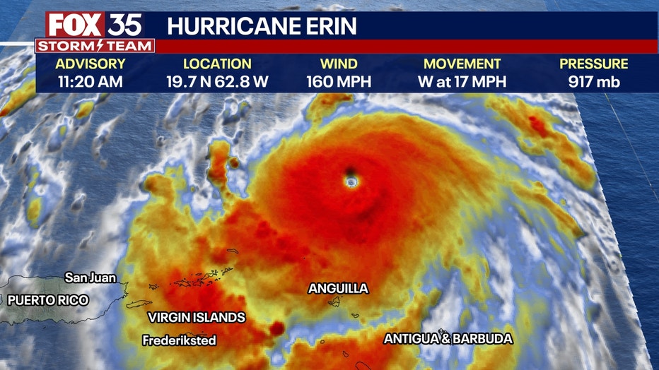
ORLANDO, Fla. – Hurricane Erin, the first major hurricane of the 2025 Atlantic hurricane season, rapidly intensified Friday night, with the storm now reaching Category 5 strength with sustained winds of 160 mph.
Here’s everything we know about the hurricane and what impacts it could bring to Florida.
Hurricane Erin upgraded to Category 4
What we know:
The National Hurricane Center (NHC) says Hurricane Erin is continuing to rapidly intensify on Saturday morning, with its outer rain bands affecting the northern Leeward Islands.
The storm is now located about 105 miles north of Anguilla and about 235 miles east-northeast of San Juan, Puerto Rico.
CLICK TO DOWNLOAD THE FOX LOCAL APP
Erin’s winds are now moving at 160 mph, with a minimum central pressure of 923 mb.
Erin is moving toward the west, and this motion is expected to continue this afternoon. A turn toward the west-northwest is expected tonight with a decrease in forward speed, and a turn toward the north is expected to occur early next week. On the forecast track, the center of Erin is expected to move just north of the northern Leeward Islands, the Virgin Islands and Puerto Rico over the weekend.
Additional strengthening of the hurricane is expected this afternoon, and fluctuations in intensity are expected for the rest of the weekend.
What impacts will Hurricane Erin have?
Dig deeper:
The outer bands of Erin are expected to continue producing areas of heavy rainfall through Sunday across the northern Leeward Islands, the Virgin Islands and Puerto Rico.
Rainfall totals of 2 to 4 inches, with isolated totals of 6 inches, are expected. Locally, considerable flash and urban flooding, along with landslides or mudslides, are possible.
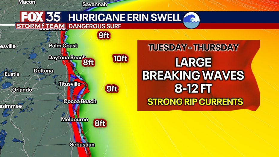
Swells generated by Erin will affect portions of the northern Leeward Islands, the Virgin Islands, Puerto Rico, Hispaniola, and the Turks and Caicos Islands through the weekend. These swells will spread to the Bahamas, Bermuda and the east coast of the United States early next week. These rough ocean conditions will likely cause life-threatening surf and rip currents.
A Tropical Storm Watch is in effect for St. Martin and St. Barthelemy, as well as Sint Maarten.
Will Hurricane Erin impact Florida?
Local perspective:
No, Hurricane Erin is not expected to directly impact Florida, as the storm is forecast to turn north and stay well east of the U.S. coastline.
However, the East Coast, including Florida’s Atlantic beaches, will likely see dangerous surf and life-threatening rip currents.
If you are on the coast, be extremely careful in the water due to the high risk of strong rip currents. Monitor local news and weather sources for the latest updates on the storm’s track and any potential changes to the forecast.
What else is happening in the topics?
Big picture view:
The NHC is also continuing to monitor a system in the northwestern Atlantic for possible development, although its chances remain low.
This broad and weak area of low pressure is located off the coast of North Carolina and is producing disorganized shower activity. Some slight development of this system is possible over the next day or two while it moves little over the warm waters of the Gulf Stream.
SIGN-UP FOR FOX 35’S BREAKING NEWS, DAILY NEWS NEWSLETTERS
By Monday, environmental conditions are expected to become unfavorable for further development.
The system currently has only a 10% chance of development over the next 48 hours and seven days.
The Source: This story was written based on information shared by the National Hurricane Center (NHC), FOX Weather and the FOX 35 Storm Team on Aug. 16, 2025.
